MTB Trails
 English
 Italiano
 Deutsch
Trail Description
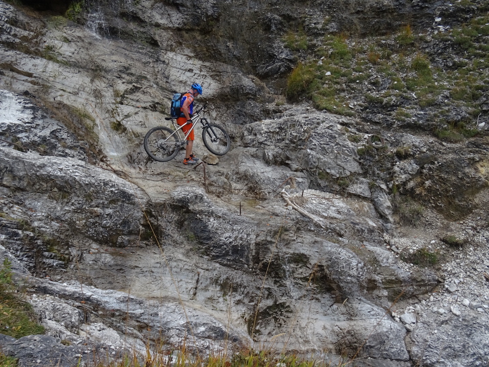
Von Krün aus zuerst der Isar entlang später links abzweigend auf einem Forstweg zur Fereinalm. Von dort hinunter zur Brandelalm. An dieser vorbei dem Forstweg folgen welcher immer schmäler wird und in einen Trail mündet. Dieser ist nicht durchgängig fahrbar (Tragestrecken oder zu gefährlich) , teilweise ist Trittsicherheit!! erforderlich aber trotzdem sehr lohnend und ein tolles Erlebnis. Am Rissbach angekommen diesem bis zu einem Wehr folgen. Dort über Treppen auf die andere Seite und einem bisweilen erdigen, schlammigen Weg bis zu einem Fortsweg (Soiernweg) folgen, diesen dann links bergauf. Nach einer Bachüberquerung links dem Weg folgen welcher zunehmend zu einem Trail wird. An dessen Ende stößt man auf einen Forstweg auf dem man rechts zur Fischbachalm gelangt. Von dort Abfahrt zurück zum Startpunkt.
http://www.gps-tour.info/en/tracks/detail.600.html
Krun from first along the Isar later branching off left on a forest path to Fereinalm. From there down to Brandelalm. At this past the forest trail which is becoming narrower and opens into a trail. This is not universally mobile (carrier routes or too dangerous), partially slip resistance !! required but very rewarding and a great experience. On Rissbach arrived this follow up to a weir. There follow via stairs on the other side and a sometimes earthy, muddy path to a Fortsweg (Soiernweg), this then left uphill. Follow after a creek crossing left the path which is increasingly becoming a Trail. At the end you come across a forest road on the right to reach the Fischbachalm. From there, exit back to the starting point.
http://www.gps-tour.info/en/tracks/detail.600.html
Map/Elevation
Pictures